
The crew of Laridae are proud to start contributing to the Secchi Disk Project by making our own Secchi disk, taking measurements during calm periods of our passages and in many anchorages, and uploading our data to the global database using the great app. We lowered the disk into the water until it just disappeared from sight and then we noted the depth below the sea surface that this occurred, the Secchi Depth, from the marks on the rope. So far, the record depth measured was 26.2 m in the middle of the Bay of Biscay!
From the Secchi Disk Project: “When a Secchi disk is lowered vertically into the water the depth below the surface at which it just disappears from sight is called the Secchi Depth. The Secchi Depth measures the clarity of the seawater, which away from estuaries and coasts indicates the amount of phytoplankton at the sea surface. By measuring the Secchi Depth you can therefore help map the ocean’s phytoplankton.”
Scientists fear the population of the microscopic beings is in decline due to rising sea temperatures and, if true, that could have consequences for every aspect of marine life. Seafarers are being encouraged to take part in a unique global study, using a Secchi disk (a simple white disk with 30 cm diameter) and a mobile phone app called Secchi to record the effects of climate change. The public science project will measure the amount of phytoplankton, minute organisms at the very start of the marine food chain, currently residing in the worlds oceans.
Construction of the Secchi disk
All members of Laridae worked together to construct our own Secchi disk. We were able to build the high-quality, marine-grade Secchi disk for £2.99 with only a saw and measuring tape! We found a durable, white kitchen cutting board for sale in Falmouth for £2.99. The size of the board was exactly 30 cm x 50 cm. This was a perfect size to achieve a 30 cm diameter Secchi disk! Angela carefully measured and sketched the 30 cm circle on the board and the adults on the boat took turn sawing the circle out of the rectangular board.
We already had a very long length of low-stretch Dyneema line that we used for CTD casts. We laid this line along the deck and used a tape measure to accurately mark Secchi depth distance measurements in 20 cm increments. Once the circle was cut and line measured, a hole was drilled in the centre to hold the measured line on the top and a weight (made from spare rigging parts!) on the bottom.

Dorian proudly displays the kitchen cutting board that will soon be our new Secchi disk.

Angela and Anneka carefully sketch a 30 cm circle on the white board.

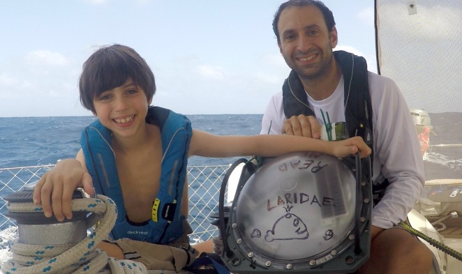
Eric takes his turn cutting the circular disk from the board.
We constructed the Secchi disk after we departed Falmouth, England while we were on passage across the Bay of Biscay to Spain. Our first measurement was conducted in the very middle of Biscay (in 4000 m water depth!) during perfect conditions; sun, calm seas, and very clear blue water. We recorded a Secchi depth of 26.2 m. We have continued to collect additional Secchi depth measurements at several of the anchorages that we have enjoyed in Spain.

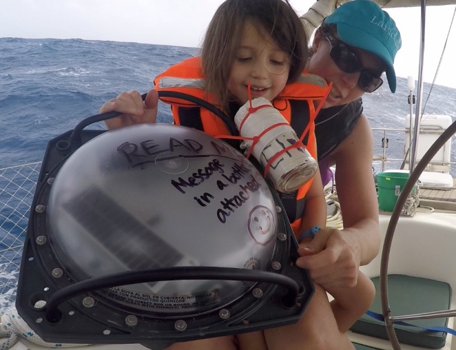
Eric preparing to lower the Secchi disk connected to the measured Dyneema line.

Measuring the Secchi depth in the clear waters of the Bay of Biscay.
We use the great Secchi app to upload the Secchi depth, location, and other relevant information to the group’s global database. Anyone can view all of the data using the interactive map of Secchi depths (shown below). For just £2.99, and a little family-fun-construction-party, you can build your own Secchi disk and start contributing to this great citizen oceanography project!
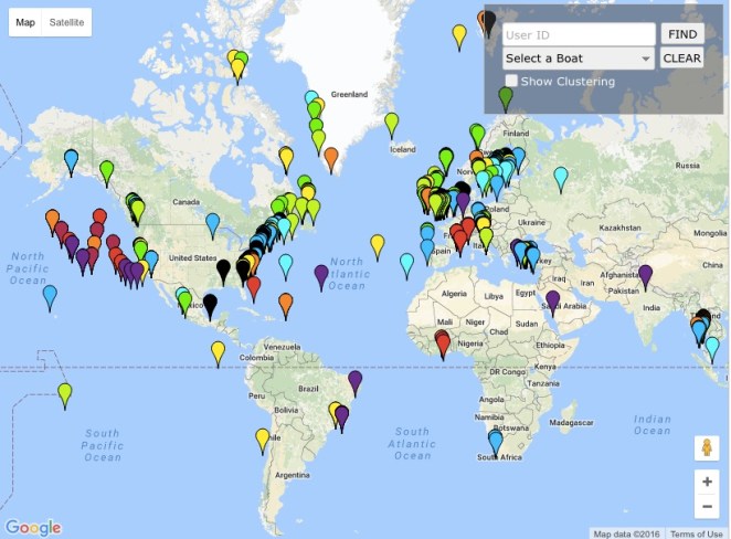
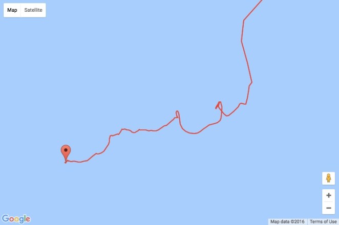
The Secchi Disk Project global database of Secchi disk measurements from citizen oceanographers.


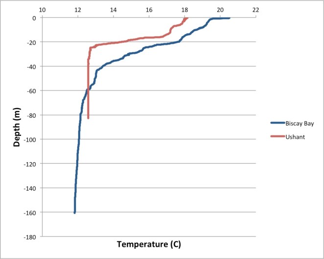 When the wind picked up from the North that evening, we were able to hoist the sails and start the fast downwind run to the corner of Spain and around Cape Finnisterre. As we sailed through the southern part of the Biscay Bay, we crossed several ocean fronts that had clear lines of different currents and waves. The frontal zones were as long as the eye could see, several hundred meters wide, and semi-periodic with a wave length of approximately 10 km. Perhaps these were internal waves reaching the surface that were enabled by the strong and shallow thermocline from the calm, warm period?


