The crew of Laridae celebrated Eric’s birthday on 16 October with the deployment of the MetOcean SVP Iridium drifter. Following a swim call in very calm conditions, the drifter was turned on and deployed overboard. The blue dome floats above the water and measures the GPS position and communicates to shore with an Iridium satellite modem. A thermometer measures the sea surface temperature. Below the surface is a large sea drogue (anchor) that fills with water so that the drifter moves with the ocean currents and does not simply drifter downwind.
The drifter was deployed at location 19° 3.950’N, 22° 37.734’W (about 200 miles NNE of Cabo Verde Islands). It reports its GPS position every one-hour and the location is mapped in real-time. The drifter typically moves in a West-Southwestward direction with the Canary Current. However, when the winds are light, it can sometimes be seen to make a small loop driven by the diurnal tide. The average speed of the current is about one knot, and we will be pleased to be carried by this current as we sail from Cabo Verde to Barbados!

Laridae crew prepare to deploy the drifter.

The sea drogue slowly sinks below the water.
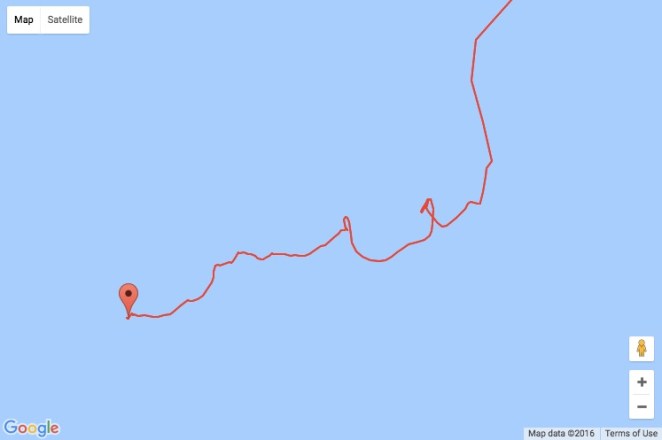
Click on the map to see the real-time tracking of the drifter.
